Antique Map Nova Scotia New Brunswick PEI NewFoundland 1923 Nice Size


$14.00
Quantity available: 1
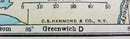
Offering this 1923 C S Hammond Atlas of the World & Gazetteer map of The Maritime Provinces including New Brunswick, Nova Scotia, Prince Edward Island, & New Foundland. This map was printed by Funk & Wagnalls Co, New York, 1923. This map does not have the actual date printed on it, but it is definitely 1923. Measures 9 1/2" x 6 1/4" (actual map size is 5" X 7"), good condition++, no holes stains, or tears, one faint line mark on margin edge - will not show when matted and framed. These maps look really nice framed, perfect desk top or wall size for your home or office, a wonderful gift!
Great Expectations Antiques
Caldwell, Ohio
Dealer accepts: Check, Money Order, Cash, PayPal
Shipping: $5.60

