Antique Map North America & Timber Supply 1910


$18.00
Quantity available: 1
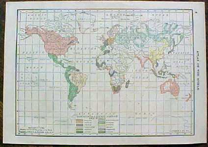
Offering this 1910 C S Hammond map of North America on one side and World Timber Supply map on the other side. This map was printed by C S Hammond & Co, New York, 1910 - it actually was part of Hammonds Handy Atlas of the World, dated 1910. This map is actually dated 1909 copyright on it (see photo).. Measures 8" x 5 3/4" (actual map size is 5" X 7"), good condition++, no holes stains, or tears. These maps look really nice framed, perfect desk top or wall size for your home or office, a wonderful gift!
Great Expectations Antiques
Caldwell, Ohio
Dealer accepts: No preferred Payment Option
Shipping: $5.60


