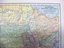
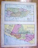
Antique Map Manitoba/British Columbia/Porto Rico 1902 Crowell


$18.00
Quantity available: 1
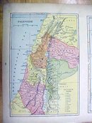
Offering this nice antique map of Porto Rico/Palestine on one side and Manitoba and British Columbia on the other. This map comes from the Peerless Twentieth Century Pictorial Gazetteer. Note the attractive colors, and clear markings! This map was published / printed by Crowell Publishing Co, New York, 1902, there is also a copyright date on this map, 1897 by The Matthews-Northrup Co., however this is an authentic map printed in 1902 - not a reproduction. The map measures 10 1/2 inches tall x 13 1/2 inches wide, very good condition, no holes or tears, some slight foxing around the outer edges mostly, considered minor as it is the natural ageing effect on this type of paper which is over 100 years old. Wonderful colors and details. These old maps are excellent for framing. A handsome piece of history for decorating your home or office!
Great Expectations Antiques
Caldwell, Ohio
Dealer accepts: No preferred Payment Option
Shipping: $7.50


