Map Philippine Islands 1912 Antique Luzon


$24.00
Quantity available: 1
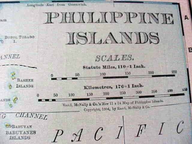
Offering this nice old 1912 map of the Philippine Islands including Luzon. This map was published / printed by Rand McNally & Co, 1912; copyright date on map is 1904. Measures 14 x 11 1/2 inches, good+ condition, no holes, tears, or stains - one faint spot on margin edge, will not show when framed & one small margin tear that has been mended with clear acid free archival tape - will not show when framed, light age toning which adds to its charm. Nice colors and details. These old maps look really great matted & framed. A handsome piece of history and unusual art piece for your home or office!
Great Expectations Antiques
Caldwell, Ohio
Dealer accepts: Money Order, PayPal, Check, Cash
Shipping: $6.00


