Map New York 1894 Lg Foldout Brooklyn Hudson


$45.00
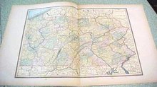
Offering this handsome colored 1894 large foldout map of the state of New York - on the backside are maps of Brooklyn, New York, and The Hudson River. This map was published / printed by The C.A.Gaskell Family & Business, Atlas of the World; John F Waite, Chicago, IL 1894. No date is printed directly on the map but it was acquired from the C.A. Gaskell Atlas, published 1894 - this is not a reproduction. Measures 13 1/2 x 22 inches, good+++ condition, no holes, tears, or stains (exception - one small margin edge tear on bottom which has been secured with clear acid free archival tape on the back side; also at fold seam at bottom there is a small margin split which has also been secured on back side - neither will show when framed); light age toning that adds to its charm. Nice colors and details. These old maps look really great matted & framed. A handsome piece of history and unusual art piece for your home or office! Shipping/insurance to any continental US address will be $6.00