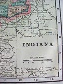
Crams Map Indiana 1898 Antique


$32.00
Quantity available: 1
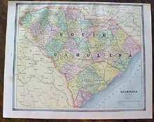
Offering this wonderful old 1898 Crams map of the state of Indiana. This map was engraved by George F Cram and printed 1898. These individual maps do not have the date on them but were part of Cram's Unrivaled Family Atlas, dated 1898, these maps are not reproductions but are authentic printed 1898. Measures 14 1/2 inches x 10 3/4 inches including blank margins. Good++ condition, no holes, stains, or tears. Very nicely detailed, excellent colors; mat and frame this handsome piece of history for your home or office or an antique gift! Shipping/insurance to continental US addresses will be $6.00
Great Expectations Antiques
Caldwell, Ohio
Dealer accepts: PayPal, Money Order, Cash, Check
Shipping: $6.00